The National Weather Service in Tallahassee called Idalia “an unprecedented event.”
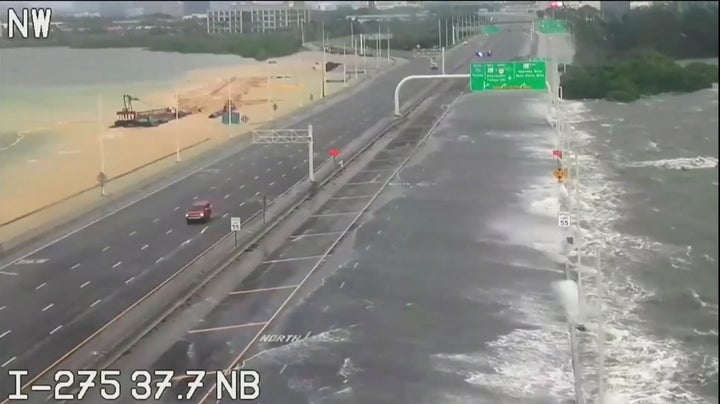
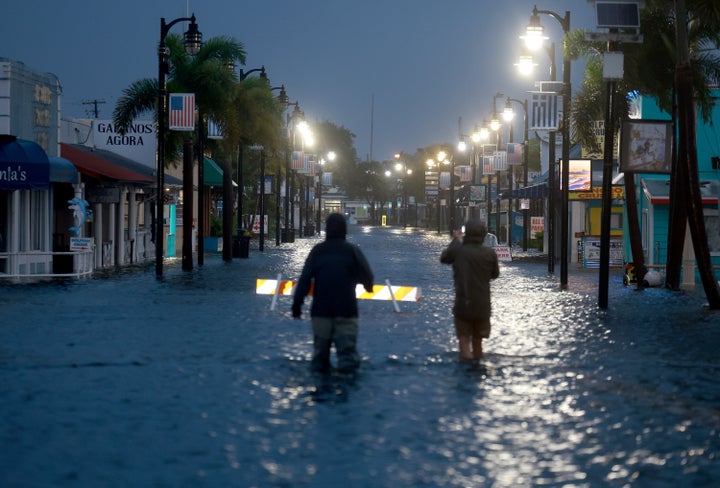
CEDAR KEY, Fla. (AP) — Hurricane Idalia made landfall Wednesday in Florida as a Category 3 storm and unleashed devastation along a wide stretch of the Gulf Coast, submerging homes and vehicles, turning streets into rivers, unmooring small boats and downing power lines in an area that has never before received such a pummeling.
More than 263,000 customers were without electricity as rushing water covered streets near the coast. As the eye moved inland, destructive winds shredded signs, sent sheet metal flying and snapped tall trees. Downed power lines closed northbound Interstate 75 just south of Valdosta, Georgia.
“We have multiple trees down, debris in the roads, do not come,” posted the fire and rescue department in Cedar Key, where a tide gauge measured the storm surge at 6.8 feet (2 meters), submerging most of hte downtown. “We have propane tanks blowing up all over the island.”

Idalia came ashore in the lightly populated Big Bend region, where the Florida Panhandle curves into the peninsula. It made landfall near Keaton Beach at 7:45 a.m. as a high-end Category 3 hurricane with maximum sustained winds near 125 mph (205 kph).
It remained a hurricane as it crossed into Georgia, with top winds of 90 mph (150 mph) at 11 a.m., after drenching Florida mostly to the east of Tallahassee. Forecasters said it would punish the Carolinas overnight as a tropical storm. Some models predicted Idalia could circle southward toward land again after that, but the National Hurricane Center forecast it to move deeper into the Atlantic this weekend.
Astounded by the flooding that turned Tampa’s Bayshore Boulevard into a river, Bill Hall watched a paddleboarder ride along the major thoroughfare.
“This is actually unbelievable,” Hall said. “I haven’t seen anything like this in years.”
Hurricane #Idalia making landfall in the Big Bend Area this morning with catastrophic storm surge. Surge concerns will continue along the west coast even though is pulling away from our area. Highest surge will be around the time of high tide this afternoon hours. Remain alert!⚠️ pic.twitter.com/kl8VmpJDjA
— NWS Tampa Bay (@NWSTampaBay) August 30, 2023
In Tallahassee, Florida’s capital city, the power went out well before the center of the storm arrived.
Tallahassee Mayor John Dailey urged everyone to shelter in place — it was too late to risk going outside. Florida residents living in vulnerable coastal areas had been ordered to pack up and leave as Idalia gained strength in the warm waters of the Gulf of Mexico.
“Don’t put your life at risk by doing anything dumb at this point,” Gov. Ron DeSantis said at a news conference Wednesday morning. “This thing’s powerful. If you’re inside, just hunker down until it gets past you.”
Storm surge could rise as high as 16 feet (4.9 meters) in some places. Some counties implemented curfews to keep residents off roads.
“For those who have chosen to remain on the beaches despite the mandatory evacuation order, please restrict your water and toilet usage,” the city of Clearwater posted. “Due to flooding, the city’s lift stations and stormwater system are under strain.”

Diane Flowers was sound asleep at 1 a.m. Wednesday in her Wakulla County home, but her husband was up watching the weather on TV, and got a text from their son when the storm was upgraded to a Category 4. He’s a firefighter/EMT in Franklin County, which is also along the Gulf Coast.
“He said, ‘You guys need to leave,’” Flowers said. “And he’s not one for overreacting, so when he told us to leave, we just packed our stuff, got in our car and got going.”
They quickly packed a few clothes, medicine, dog food for their two border collies, a computer, important documents and a bag of Cheetos. Motels were packed all the way into Alabama, where they ended up finding a room in Dothan.
The National Weather Service in Tallahassee called Idalia “an unprecedented event” since no major hurricanes on record have ever passed through the bay abutting the Big Bend. The state, still dealing with lingering damage from last year’s Hurricane Ian, feared disastrous results.
Not everyone heeded the warnings to leave, and Hernando County Sheriff Al Nienhuis said they couldn’t guarantee rescues for people who didn’t evacuate, since coastal roads would only get more flooded as high tide pushes more water inland.

“It’s going to do nothing but go up from here,” Nienhuis, whose county is north of the Tampa area, said Wednesday morning.
Idalia had grown into a Category 2 system on Tuesday afternoon and became a Category 3 just hours earlier Wednesday before strengthening to a Category 4 and then weakening slightly to a high-end Category 3.
Hurricanes are measured on a five category scale, with a Category 5 being the strongest. A Category 3 storm is the first on the scale considered a major hurricane and the National Hurricane Center says a Category 4 storm brings “catastrophic damage.”
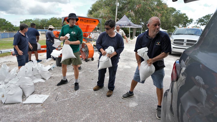
Tolls were waived on highways out of the danger area and shelters were opened. More than 30,000 utility workers were gathering to make repairs as quickly as possible in the hurricane’s wake. About 5,500 National Guard troops were activated.

Both Georgia Gov. Brian Kemp and South Carolina Gov. Henry McMaster announced states of emergency, freeing up state resources and personnel, including hundreds of National Guard troops.
As the winds begain to lash coastal Georgia Wednesday morning, customers where still visiting Mary Hennig’s bait and tackle shop on St. Simons Island for snacks and coffee.
“Hurricanes here haven’t been what they keep saying they’re going to be,” Hennig said. “So people aren’t going to take it as seriously.”
Asked about the hurricane Tuesday, President Joe Biden said he had spoken to DeSantis and “provided him with everything that he possibly needs.”
Ian was responsible last year for almost 150 deaths. That Category 5 hurricane damaged 52,000 structures, nearly 20,000 of which were destroyed or severely damaged.
The National Oceanic and Atmospheric Administration recently said the 2023 hurricane season would be far busier than initially forecast, partly because of extremely warm ocean temperatures. The season runs through Nov. 30, with August and September typically the peak.
Credit: Source link