After a storm dumped two months of rain in two days, a dam upstream from Montpelier could overflow in the city where the water is already waist-high.
ANDOVER, Vt. (AP) — A storm that dumped up to two months of rain in two days in Vermont and other parts of the Northeast brought more flooding Tuesday to communities marooned by water, including the state capital, where a dam just upstream was threatening to overflow.
The flooding has already caused tens of millions of dollars in damage, officials said, with more to come: If water pours over the dam on the Winooski River that flows through Montpelier, it could surge through downtown blocks where the floods were already waist-high.
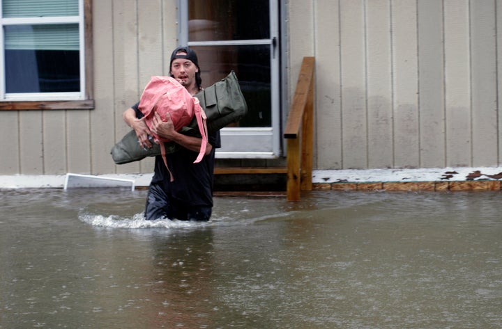
“Floodwaters continue to rise in some places, like our capital city, and have surpassed the levels seen during Tropical Storm Irene,” Vermont Gov. Phil Scott said. Irene killed six people in Vermont in August 2011, washing homes off their foundations and damaging or destroying more than 200 bridges and 500 miles (805 kilometers) of highway.
The sun was out Tuesday and more sunshine was expected Wednesday. But more rain was forecast Thursday and Friday.
“We are not out of the woods,” Scott said. “This is nowhere near over.” He tweeted that the roads around his house were impassable Tuesday morning, so he had to hike through the woods to reach the state’s emergency response center.
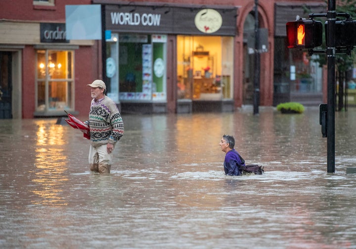
One woman was swept away in New York. There have been no reports of injuries or deaths related to the flooding in Vermont, where swift-water rescue teams aided by National Guard helicopter crews have done more than 100 rescues, Vermont Emergency Management said Tuesday.
That included an “extremely high-risk rescue” by a visiting New Hampshire team, of a person who decided to drive around a barricaded road, said Mike Cannon of Vermont Urban Search and Rescue. “The car was washed off the roadway almost into the river,” he said, urging drivers to pay attention to road closures.
Dozens of roads and highways were closed, including many along the spine of the Green Mountains, and flash flood warnings and advisories were in effect for much of the state, from the Massachusetts line to Canada.
Downtown Montpelier, a city of 8,000, was swamped between the capitol building and the Winooski River. Montpelier Town Manager Bill Fraser warned that the Wrightsville Dam several miles to the north could exceed capacity for the first time.
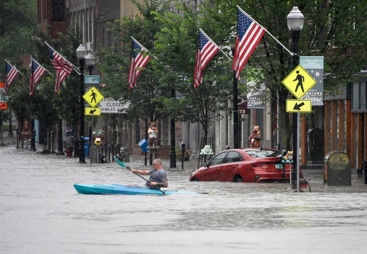
“There would be a large amount of water coming into Montpelier which would drastically add to the existing flood damage,” he said, adding that there are very few evacuation options remaining. “People in at risk areas may wish to go to upper floors in their houses.”
Just before noon on Tuesday, Montpelier Police said waters had risen to within a foot of the top of the dam, and every foot of water that goes over the spillway would double the flow into the city.
Multiple rescue crews were positioned in Montpelier, where dispatch, police and fire operations were relocated to a water treatment plant after heavy flooding at City Hall and the police and fire departments. Also, the radio towers they use for emergency calls are not functional, Police Chief Eric Nordenson said.
Shelters were set up at churches and town halls, but at least one refuge had to close as flooding worsened. Delivering food and water to more than 200 people sheltering at the Barre Municipal Auditorium has been a challenge.
“We’re trying to find paths to get supplies in to them,” said John Montes, American Red Cross of Northern New England regional disaster officer.
The slow-moving storm reached New England after hitting parts of New York and Connecticut on Sunday. Some communities received between 7 and 9 inches (18 centimeters and 23 centimeters) of rain by Monday night. Towns in southwest New Hampshire had heavy flooding, and road washouts earlier in the week.
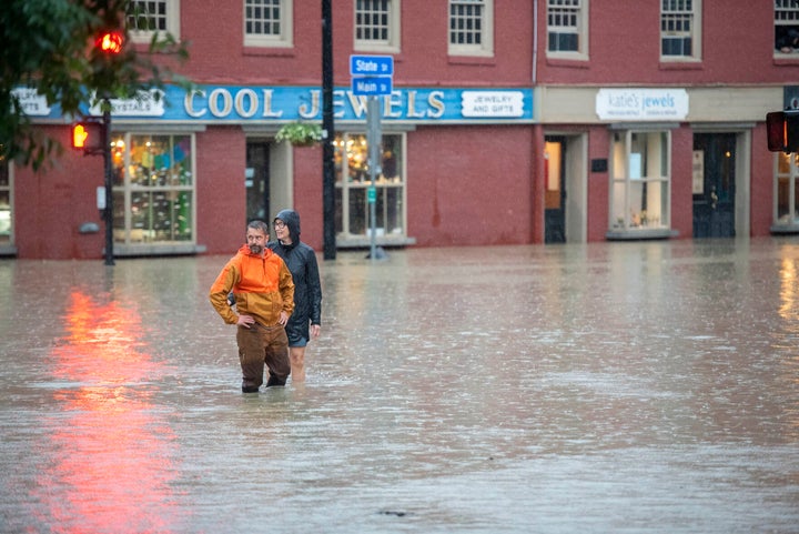
Syd Straw, who was trapped in her house near the small town of Weston, appreciated Tuesday’s sunshine, but said she still had water in her basement and a crumbled driveway that reminded her a bit of the Grand Canyon.
“I can hike out of my broken driveway and get onto the sliver of dirt road that remains,” she said.
The Connecticut River, swollen from the heavy rains in Vermont, was expected to crest above flood stage Wednesday in Hartford and towns to the south, causing minor to moderate flooding, according to the National Weather Service.
President Joe Biden, attending the annual NATO summit in Lithuania, declared an emergency for Vermont and authorized the Federal Emergency Management Agency to help coordinate disaster relief efforts and provide assistance.
FEMA sent a team to Vermont, along with emergency communications equipment, and is prepared to keep shelters supplied if the state requests it. The agency also is monitoring flooding in Massachusetts, Connecticut and New Hampshire, regional spokesperson Dennis Pinkham said Tuesday.
White House press secretary Karine Jean-Pierre urged people on Tuesday “to please, please be safe, and follow safety protocols.”
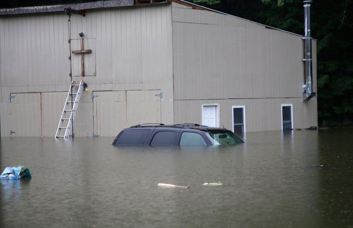
Road crews cleared debris Tuesday, reopening Interstate 89 as it follows the river between Montpelier and Middlesex. Rescuers from North Carolina, Michigan and Connecticut joined Vermonters in among those reaching towns that had been isolated since torrents of rain began belting the state.
One of the worst-hit places was New York’s Hudson Valley, where a woman identified by police as Pamela Nugent, 43, died as she tried to escape her flooded home with her dog in the hamlet of Fort Montgomery.
The U.S. Military Academy at West Point was pounded with more than 8 inches (20 centimeters) of rain that sent debris sliding onto some roads and washed others out.
“Nine inches of rain in this community,” New York Gov. Kathy Hochul said during a briefing on a muddy street in Highland Falls, just south of the academy on the west bank of the Hudson River. “They’re calling this a ‘1,000 year event.’”
Atmospheric scientists say destructive flooding events like these happen more frequently as storms form in a warmer atmosphere, and the planet’s rising temperatures will only make it worse.
Credit: Source link